Mapping Egyptian Airfields
Locations, Coordinates, History

Egypt maintains a broad infrastructure of primary air bases, secondary installations, and reserve airstrips. This network reflects the layered history of Egyptian aviation. Several air bases originated as British Royal Air Force installations during WWII, while others were built or expanded during the Cold War and later decades. More recently, new airfields have appeared in remote desert regions tied to border security, infrastructure projects, and strategic developments in the Western Desert and Red Sea corridor.
Administratively, the Air Force is divided into four geographical manāṭiq ǧawiyya (Air Zones): Eastern, Western, Southern, and Central, as well as alwiya ǧawwiya (Air Wings) that oversee asrāb (Squadrons).
What follows is an open-source mapping of Egyptian air bases and auxiliary airfields, compiled from satellite imagery, aviation databases, historical records, and defense reporting.
This is a personal research effort and may contain inaccuracies or omissions. Readers with additional information, corrections, or sources are warmly invited to contribute. Many thanks to Mostafa for revising the coordinates I collected.
Airfields
Abu Hammad (El-Sheikh Gebeil) — 30°35’39”N 31°39’58”E (اشيخ جبيل / أبو حماد)
The base in Sharqiya Governorate houses the Command of the Air Wing 550, which operates AH-64 Apache helicopters, and is associated with a crash that killed two pilots in 2016.
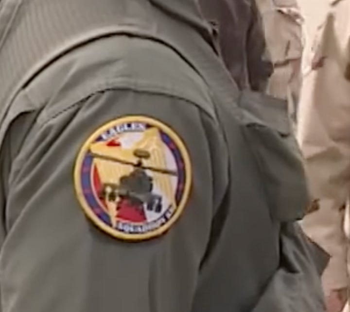
The 52nd Squadron of the 550th Air Wing.


Abu Simbel — 22°22’33”N 31°36’42”E (أبو سمبل)
A civilian airport near the Sudanese border. Egyptian Border Guard facilities operate in the surrounding area, and the runway could potentially serve as a dispersal or auxiliary airstrip.
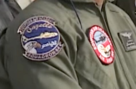
Abu Sultan (Deversoir) — 30°25’23”N 32°20’07”E (أبو سلطان / دفرسوار)
Located approximately 19 km south-southeast of Ismailia and 116 km northeast of Cairo. It was formerly a major British Royal Air Force station known as RAF Deversoir, built before WWII. Currently, the base reportedly houses two squadrons used for training in flying the Aérospatiale Gazelle helicopters.
Abu Suwayr — 30°34’21”N 32°05’45”E (أبو صوير)
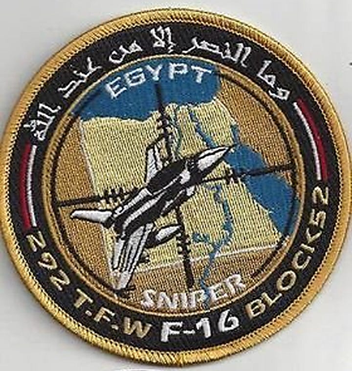
Located approximately 17.1 kilometers west of Ismailia and 116 km northeast of Cairo. It is positioned for strategic defense of the Suez Canal waterway. During WWII, it was used by the British and US air forces. Now it houses the 60th Squadron of the 262nd Tactical Fighter Wing, flying F-16C/D Block 40 Fighting Falcon.
Almaza (Cairo Almaza) — 30°05’33”N 31°21’35”E (القاهرة ألماظة)
A historic air base in northeast Cairo, Almaza has long served as one of the Egyptian Air Force’s principal hubs for transport, training, and VIP operations.
Anshas — 30°19′46.69″N 31°27′00.70″E (أنشاص)
One of the oldest military airfields in the country, Anshas lies in Sharqia within a dense cluster of installations east of Cairo, adjacent to the Sa‘iqa (Army Rangers) School.
Arish — 31°04’24”N 33°50’09”E (العريش)
A strategic airfield in North Sinai near the Mediterranean coast, Arish has been used for both civilian and limited military operations (permitted by the Israelis and the Multinational Force & Observers [MFO]) and is situated in a heavily securitized zone associated with counterinsurgency activities on the peninsula.
Aswan — 23°57’54”N 32°49’24”E (أسوان)
A civilian airport that has a military presence.
Beni Sueif — 29°12’43”N 31°00’57”E (بني سويف)
A military air base in Upper Egypt along the Nile Valley, Beni Sueif, anchors air operations south of Cairo. Its location makes it a key node linking the capital’s air defense belt with central and Upper Egypt. It houses the command of the 242nd Tactical Fighter Wing, which operates F-16s.
Bernice (Ras Banas) — 23°58’27”N 35°27’37”E (برنيس / راس بناس)
A massive military base on the Red Sea, houses MiG-29s and F-16s.
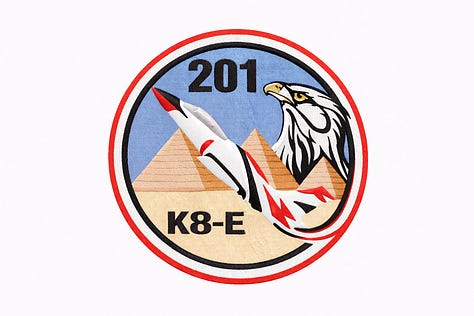
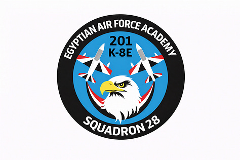
Bilbeis — 30°23’42”N 31°36’05”E (بلبيس)
Located in Sharqia, east of Cairo, the base hosts the Air Force College, overseen by:
The 3rd and 5th Squadrons of the 101st Air Brigade, which train the cadets on Grob 115EG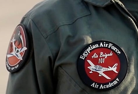
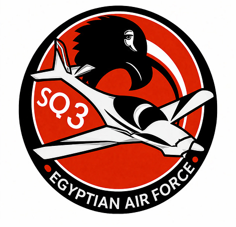
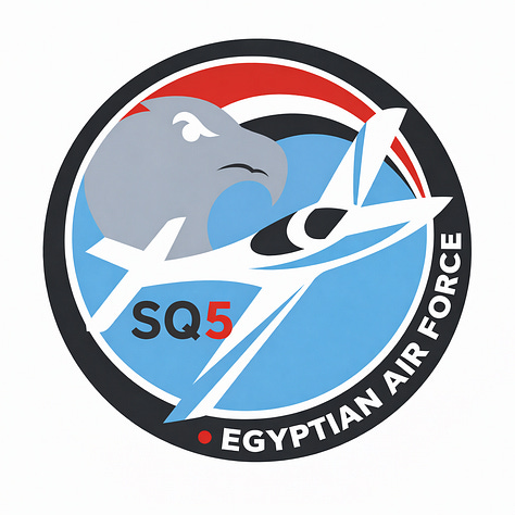
The 28th and 29th Squadrons of the 201st Air Wing, which train on the K-8E
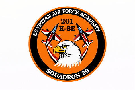
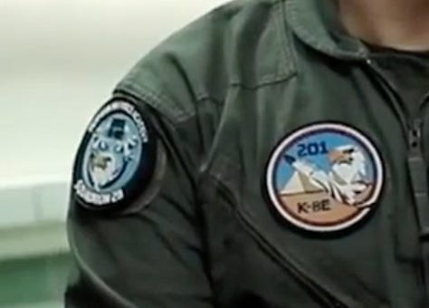
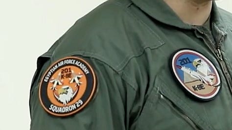
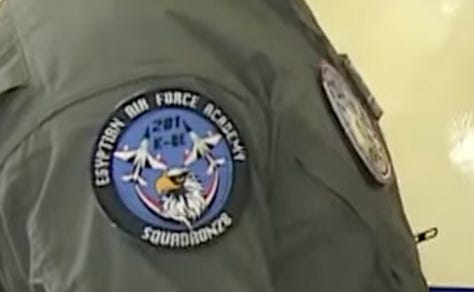
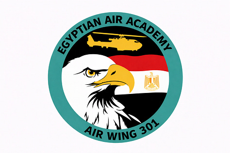
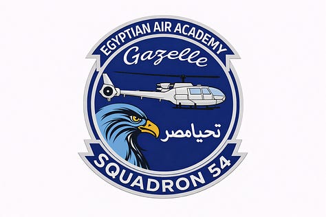
The 54th Squadron of the 301st Air Wing, which trains on the SA342L
Bir Abu Rahal — 24°59’37”N 33°30’06”E (بير أبو رحال)
Reserve military air base.
Bir Jifjafa (Melez) — 30°24’31”N 33°09’27”E (بير جفافة / ميليز)
A desert airstrip in central Sinai. The site appears to function as an auxiliary or emergency airfield and could serve as a reserve or dispersal strip during wartime.
Borg el-Arab — 30°55’05”N 29°41’45”E (برج العرب)
A civilian airport that has a military presence of helicopter squadrons.
Cairo East (military section of Cairo International Airport) — 30°07’59.66”N 31°24’40.97”E (المنطقة العسكرية داخل مطار القاهرة الدولي)
Cairo West — 30°06’59”N 30°54’56”E (غرب القاهرة)
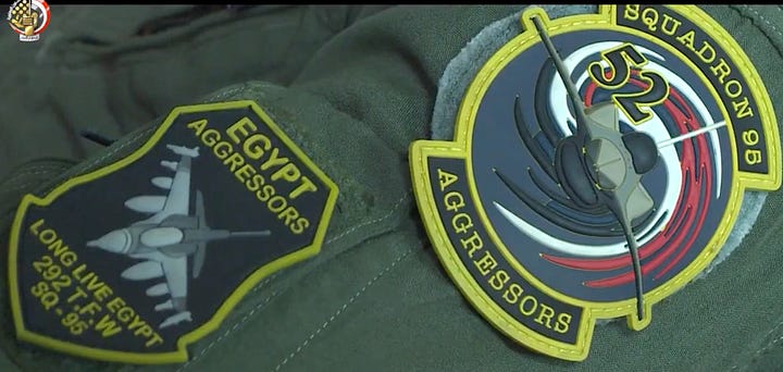
A major military air base west of Cairo that acts as a vital hub for transport, logistics, and foreign military collaboration. It hosts the 292nd Tactical Fighter Wing, which operates two F-16 squadrons: the 95th and 97th.
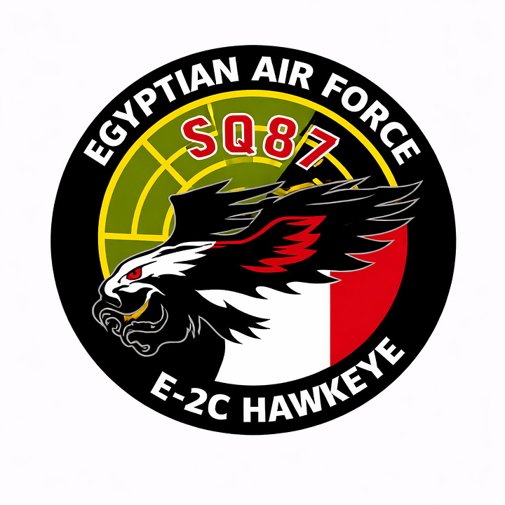
In addition to the 601st Air Wing, which manages the 87th Squadron—E-2C Hawkeye airborne early warning aircraft.
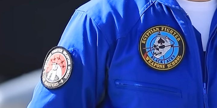
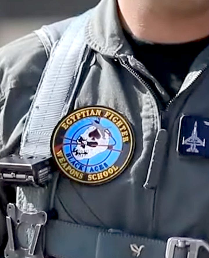
The base also hosts the Egyptian Fighter Weapons School.


Capital International Airport — 30°03’01”N 31°50’22”E (مطار العاصمة الدولي)
A civilian airport at the New Administrative Capital that has a military presence. Some aviation maps refer to it by Wadi al-Jandali.
Dakhla — 25°25′15″N 29°00′01″E (الداخلة)
Dakhla Oasis Airport, located about 11 km south of Mut in New Valley Governorate, serves the remote al-Dakhla oasis with a limited passenger capacity of roughly 100 passengers per hour. The facility is a dual-use airport, combining civilian operations with military functions, featuring a 2,589-meter runway and basic infrastructure capable of handling small to medium aircraft.
Daraw — 24°24’51”N 32°57’17”E (دراو)
A small military airfield near Daraw in Aswan Governorate, often confused with Aswan International Airport. The site is associated with a 2012 MiG-21 crash that killed its pilot during a training flight.
El-Alamein — 30°55′58″N 28°27′02″E (العلمين)
A civilian airport that has a military presence.
Fayid — 30°20’04”N 32°15’50”E (فايد)
A strategic airbase close to the Suez Canal, houses F-16s.
Gabal el-Basur — 30°32’24”N 30°33’38”E (جبل الباسور)
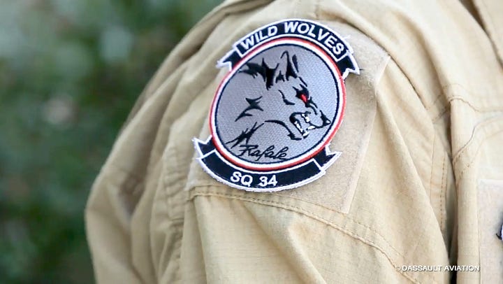
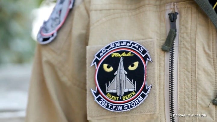
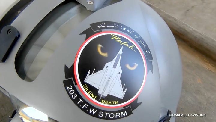
A strategic airbase in Monofiya Governorate, housing Rafales operated by the 34th and 84th Squadrons of the 203rd Tactical Fighter Wing, and Mirages operated by the 82nd Squadron of the 252nd Tactical Fighter Wing.
Gabal Libni — 30°48′05.73″N 33°46′46.08″E (جبل لبني)
A former airfield in Northern Sinai. Declassified CIA imagery from June 1967 shows Egyptian decoy MiG-15 aircraft deployed at the site before the Six-Day War. Israel later used the airfield during the occupation of Sinai, but the base was abandoned after the 1979 peace treaty. Today, only faint traces of the runway and revetments remain visible in satellite imagery, and the site appears inactive.
Gorah — 31°5’3”N 34°8’35”E (الجورة)
A former Israeli military airbase (Eitam), in use by the MFO since 1982.
Habata — 31°06’27”N 25°27’08”E (حباطة)
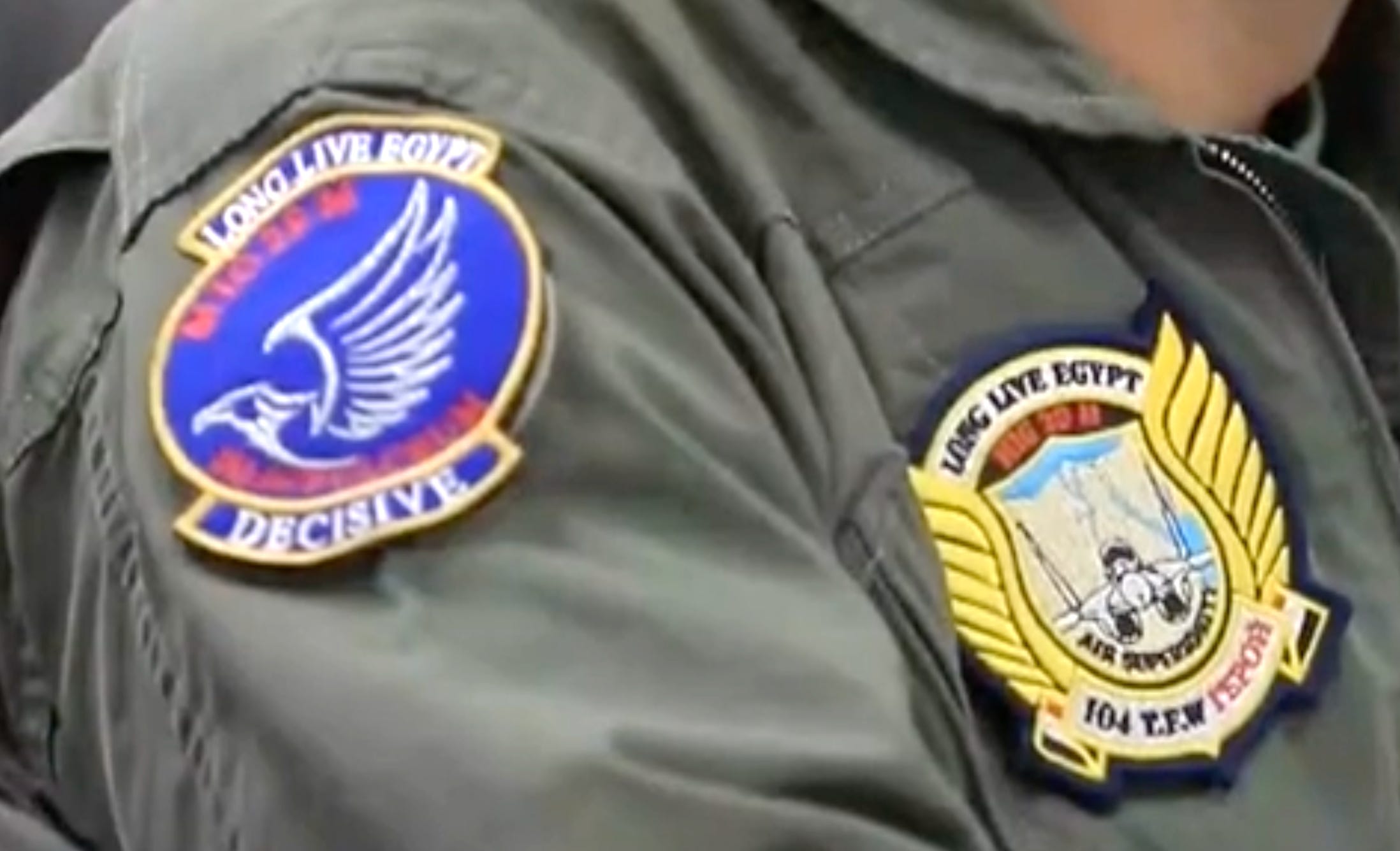
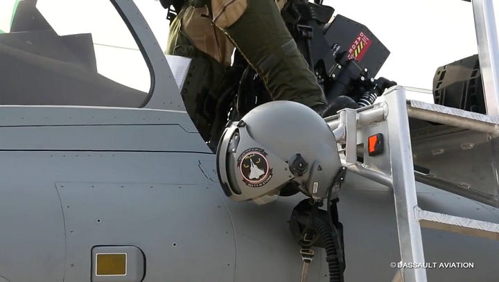
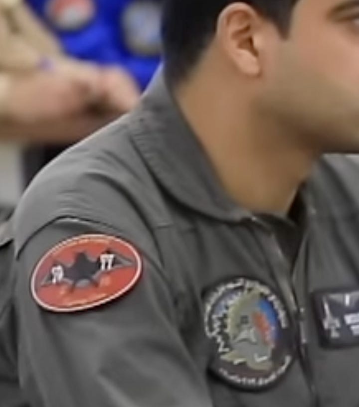
A small military base, which expanded massively from 2019 to 2022. Satellite imagery showed stationed MiG-29Ms (operated by the 44th Squadron of the 104th Tactical Fighter Wing) and Rafales (operated by the 36th Squadron of the 203rd Tactical Fighter Wing). It likely serves aerial operations in support of the eastern Libyan warlord Khalifa Haftar.

Patches of the 44th Squadron and the 104th Tactical Fighter Wing Helwan — 29°49′17.38″N 31°19′50.30″E (حلوان)
A former British Royal Air Force base, now used for aerial training and testing.
Hurghada — 27°11’03”N 33°47’54”E (الغردقة)
A civilian airport that has a military presence.
Ismailia — 30°35′53.75″N 32°14′12.86″E (الإسماعيلية)
Located near the city of Ismailia along the Suez Canal corridor, this air base sits within a dense cluster of military installations that includes Abu Suwayr, Abu Sultan, and Fayid. The site traces its origins to the Second World War and appears to remain active, likely supporting helicopter operations.
Jiyanklis — 30°49’18”N 30°11’35”E (جناكليس)
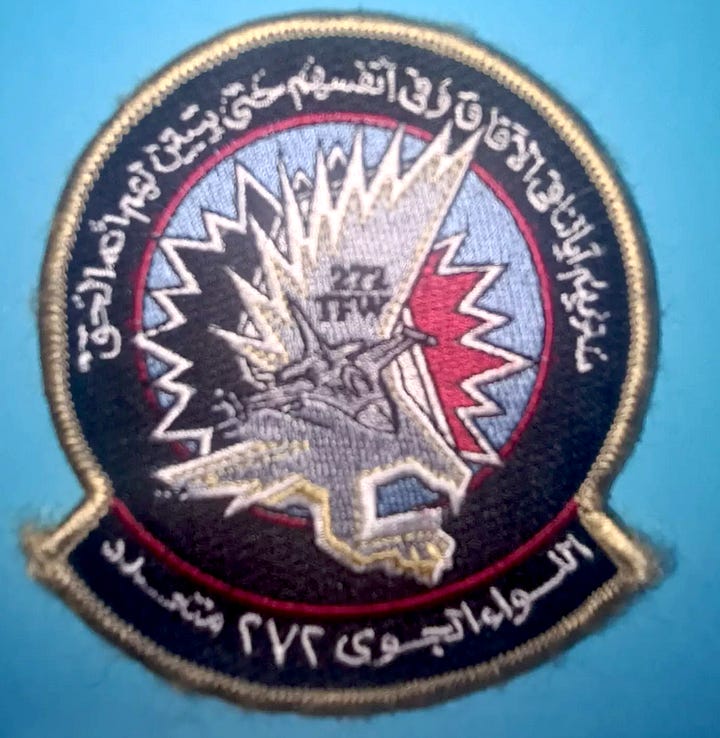
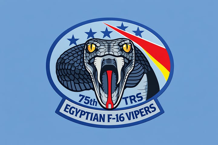
A former British Royal Air Force base, now an important hub hosting the 272nd Tactical Fighter Wing, which operates three F-16 Fighting Falcon Squadrons: the 75th (Tactical Reconnaissance), 77th, and 79th (Training).

Khatatba — 30°18′40″N 30°52′35″E (الخطاطبة)
A small airfield, likely used for helicopters.
Kibrit — 30°14’48”N 32°29’32”E (كبريت)
A former British Royal Air Force base, which continued to play a strategic role in the Arab-Israeli wars. Its importance has been overshadowed by other bases eventually, and now it houses mainly Gazelle helicopters.
Kom Awshim — 29°33’15”N 30°53’42”E (كوم أوشيم)
An airbase in Fayoum that houses mainly Chinooks and is associated with a 2014 crash of a military transport plane during training, leading to the death of six crew members.
Luxor — 25°40′54″N 32°42′42″E (الأقصر)
A civilian airport, also used for military purposes, adjacent to the headquarters of the Southern Air Zone Command.
Mansoura — 30°57′54″N 031°25′58″E (المنصورة)
Hosts the Eastern Air Zone Command.
Marsa Matrouh — 31°19’28”N 27°13’20”E (مرسى مطروح)
The base hosts the Western Air Zone Command, and houses Mirages, Chengdu F-7 fighters, and FT-7 two-seat trainer aircraft.
Minya — 28°5’58.72”N 30°43’50.46”E (المنيا)
A relatively small airfield, used for training jets, such as the Karakorum-8E and the Dassault/Dornier Alpha Jet.
Misheifa — 31°01’41”N 25°51’04”E (مشيفة)
A remote desert airstrip in the Western Desert east of Sidi Barrani. The site appears to function as an auxiliary or emergency landing field that could support dispersal operations during wartime.
Port Said — 31°16′52″N 32°14′28″E (بورسعيد)
A civilian airport that has air defense installations and military hangars.
Quwaysina — 30°34’46”N 31°07’44”E (قويسنا)
A former military airbase, with a stalled project to convert it to a civilian/commercial airport. Contrary to the information circulating in aviation forums, it’s currently empty.
Salihiyah — 30°47’37”N 32°02’40”E (الصالحية)
Reserve airbase.
Sharq el-Owainat — 22°35′06.20″N 28°43′09.96″E (شرق العوينات)
A remote desert airfield near the Sudan-Libya-Egypt border triangle. Built to serve the Sharq el-Owainat agricultural project, the airport has reportedly developed a military component and has been linked by a New York Times investigation to Turkish drone operations supporting the Sudanese army.
Sidi Barrani — 31°28’01”N 25°52’52”E (سيدي براني)
Reserve airbase.
Tanta — 30°50’21.1”N 30°56’03.8”E (طنطا)
Hosts the Central Air Zone Command.
Uthman (Siwa) — 29°33’20”N 25°35’15”E (عثمان / سيوة)
The base hosts Air Tractor AT-802 aircraft, Wing Loong II drones, and Mi-17V-5 helicopters used for counterinsurgency and counter-smuggling operations.
Wadi Abu Rish — 28°58’30”N 31°41’56”E (وادي أبو ريش)
An important base part of the southern air defense, houses MiG-29s assigned to the 104th Tactical Fighter Wing.
Wadi Abu Shiha (Wadi Qena) — 26°33’31”N 33°07’28”E (وادي أبو شيحة / وادي قنا)
A little-known airstrip in the Eastern Desert west of the Red Sea coast. The runway appears to function primarily as an auxiliary or reserve landing strip. It was the launch base for Operation Eagle Claw, the 1980 failed US rescue attempt of the embassy hostages in Tehran.